

How it works
This feature helps users identify potential deal-killers by instantly decoding complex zoning codes to understand buildability and development potential. It utilizes 3D analysis to identify physical limitations like steep slopes, flood plains, and wetlands, and provides comprehensive site intelligence by mapping utility lines, verifying road access, and previewing title information to ensure informed decisions and avoid costly surprises.
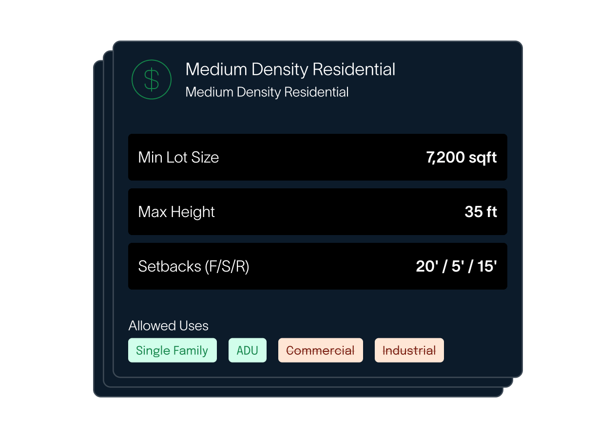
Uncover Zoning & Buildability
Instantly decode complex zoning codes to understand what can be built on a property. Access allowable use matrices, setback requirements, and eligibility for additional dwelling units to ensure development potential. This critical first step helps you quickly assess a parcel's development viability.
Analyze Physical Constraints
Utilize 3D analysis to identify critical physical limitations like steep slopes, flood plains, and wetlands. Overlay FEMA flood maps and assess topography to avoid unbuildable land and potential deal-killers. This comprehensive environmental review ensures you understand the true nature of the land.
Comprehensive Site Intelligence
Gain insights into essential infrastructure by mapping utility lines for power, water, and sewer. Verify legal and physical road access, and preview title information to proactively identify any encumbrances or legal issues. This detailed site intelligence empowers you to close with confidence.
Beyond the Surface: Deep Dive into Property Potential
Acrematic's Advanced Due Diligence goes beyond basic checks, providing a holistic view of any parcel. From decoding intricate zoning regulations to revealing hidden physical constraints through 3D analysis, our platform ensures you have all the critical information. We also provide crucial utility intelligence, road access verification, and title previews, empowering you to make informed decisions and avoid costly surprises.
Know exactly what you can build.
Zoning codes are complex and vary by county. We decode them instantly, telling you exactly what’s allowed, what’s prohibited, and the dimensional standards you need to follow.
- Instant zoning code lookup and translation
- Allowable use matrix (Residential, Ag, Commercial)
- Setback, height, and coverage requirements
- ADU and density bonus eligibility
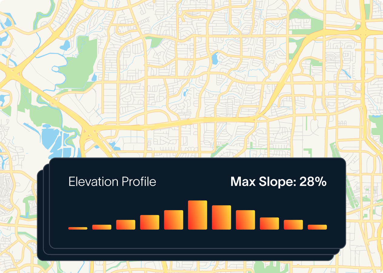
See the land without leaving your desk.
Physical constraints kill deals. Our 3D analysis engine reveals steep slopes, flood plains, and wetlands that aren’t visible on a standard satellite map.
- Flood Zone Mapping
Overlay FEMA flood maps directly onto the parcel boundaries to see encroachment. - Topography & Slope
Identify buildable flat areas versus steep, unbuildable terrain.
"What used to take days of digging through county records now takes minutes. The 3D analysis and instant zoning lookups have helped us avoid several costly mistakes by identifying physical constraints early in the process"

Enquire about Advanced Due Diligence
Join our newsletter
Get the latest industry insights, trends, and tips delivered straight to your inbox.